


Octave GeoMedia
A GIS platform for enterprise master plans and corporate GIS: direct access to Oracle, SQL Server and PostGIS, dynamic analysis, data quality control, network management.
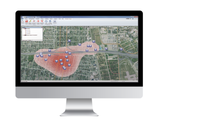
Octave GeoMedia is a GIS platform that brings data from different sources and formats into a single map for processing, analysis, presentation and sharing. GeoMedia is used to build digital master plans for infrastructure-heavy enterprises and corporate GIS for organizations that operate roads, railways, pipelines, waterways and utility networks.
In 2026 the product was named Octave GeoMedia as part of the Hexagon → Octave rebrand; functionality, versions and contracts remain unchanged.
GeoMedia connects directly to Oracle, SQL Server and PostGIS databases without import or conversion, reads common geospatial and CAD formats, Esri files, KML and OGC web services — and displays them together in one unified map window.
The platform comes in three tiers — Essentials, Advantage and Professional — so the feature set can be matched to the task and budget. For publishing data through web applications, GeoMedia works together with Octave Alto Enterprise.
Softprom is an Octave partner: we help choose the right GeoMedia tier for the task and arrange a demonstration and a pilot project.
Features
Data Access Without Conversion
- Direct connection to Oracle, SQL Server and PostGIS — no import or intermediate files.
- Common geospatial formats, most CAD formats, Esri ArcView and GeoDatabase, KML, text files.
- OGC web services: WMS, WMTS, WFS.
- The Octave Alto Data Management (ex-ERDAS APOLLO) catalog explorer for spatial search and display of imagery directly in the map window.
Data Quality Control
- Checks for attribute completeness, geometry validity and compliance with the organization’s data model.
- Tracking and control of user changes, a quality checkpoint before the database is updated.
- Intelligent modeling of network features — sewer, water, electricity, gas — preserving the relationships between nodes.
- Temporal queries and visualization: what changed in the network over a period, and why.
Dynamic Analysis
- Queries across several databases and files at once, on different platforms.
- Chained queries: the result of one feeds the next dynamically, with no intermediate files.
- Automatic refresh of results when the source data changes — a current picture and “what if” analysis for strategic planning.
- Linear networks with routing, a multi-level linear referencing system (MLRS).
- Geocoding, address matching and conversion between coordinate reference systems (CRS).
Enterprise Productivity
- Tools for creating, editing and maintaining vector features in corporate geodatabases.
- Many concurrent users, content sharing within a department or across the enterprise.
- Centralized standards for styles, text, queries and analysis for consistent teamwork.
- Interface customization for specific workflows.
Three Tiers of Octave GeoMedia
- GeoMedia Essentials. Queries and analysis of various geospatial data sources, basic image preparation.
- GeoMedia Advantage. Everything in Essentials plus data capture and editing, elevation and terrain processing including LiDAR, data validation, raster analysis.
- GeoMedia Professional. Everything in the previous tiers plus the full set of capture tools, corporate geodatabase maintenance and advanced analysis.
Typical Use Cases
- Enterprise digital master plan. A single model of the site, buildings and networks with current data.
- Corporate GIS on existing databases. Working with Oracle / SQL Server / PostGIS without data migration.
- Linear networks and utilities. Roads, railways, pipelines, waterways, utility networks.
- Public safety and maintenance priorities. Network analysis for repair and spending decisions.