



Octave Alto Enterprise (ex-M.App Enterprise)
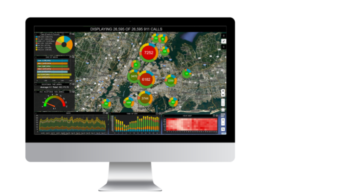
A platform for building your organization’s geospatial applications: 2D/3D maps, dashboards, analytics and workflows for field teams.
Octave Alto Enterprise (ex-M.App Enterprise) is a platform for building geospatial applications within an organization: imagery, vector data, point clouds, workflows, analytics, and queries are stored in one place and accessed through a simple user interface.
In 2026, M.App Enterprise was renamed Octave Alto Enterprise as part of the Hexagon → Octave rebrand; functionality and contracts remain unchanged.
The platform lets you monitor infrastructure, transport, land parcels and any other assets by processing sensor, weather and operational data together. Analysis results, including machine-learning algorithms, are displayed in 2D and 3D on interactive dashboards, while field workers collect data on mobile devices — even without internet access.
Alto Enterprise is the ready-made platform; it runs on the Octave Alto libraries, and for a facility digital twin there is a separate solution, Octave Alto Twin.
Softprom is an Octave partner: we help define the data and applications to start with and arrange a demonstration and a pilot project.
Features
Desktop, Web and Mobile Clients
- A desktop client with a full set of GIS functions for professional users.
- A browser client with 2D and 3D maps and a set of ready-made BI widgets.
- A mobile app for access from anywhere, including offline.
Connection to Any Spatial Data Source
- Direct connection to Oracle, Microsoft SQL Server and PostGIS databases.
- OGC WMS, WMTS and WFS services for your applications.
- Integration with Octave Alto Server (ex-LuciadFusion) — direct connection to more than 200 data sources and alternative views of the terrain.
Business Process Configuration
- Standard workflows for daily operations in an enterprise environment.
- Lifecycle rules, function-level access control, data validation, integration with other systems.
- Attribute editing through lists and forms.
Geoprocessing Engine
- Run spatial models, analyze data and create your own output datasets.
- Hundreds of functions and analytical procedures, including machine-learning algorithms for supervised and unsupervised classification of rasters and vectors.
Role-Based Access
- Users see only the applications assigned to them.
- Administrators assign roles, create and configure applications, and view statistics.
- User management out of the box or through an existing authentication system.
Typical Use Cases
- Urban and regional planning. Maps, dashboards and scenarios on one platform.
- Infrastructure and asset monitoring. Sensor and operational data together with spatial data.
- Field work. Data collection on mobile devices and return to a single database.
- City digital twin. The platform layer for solutions of this kind.